Support the project using PayPal
Select your language

")

100% no adversisements
Support to Android wear devices
Online map viewer. The tiles used online can be cached, and can be used offline after
Create offline maps from online sources
Build composite maps from online map sources, with different values of transparency
Support to WMS online maps
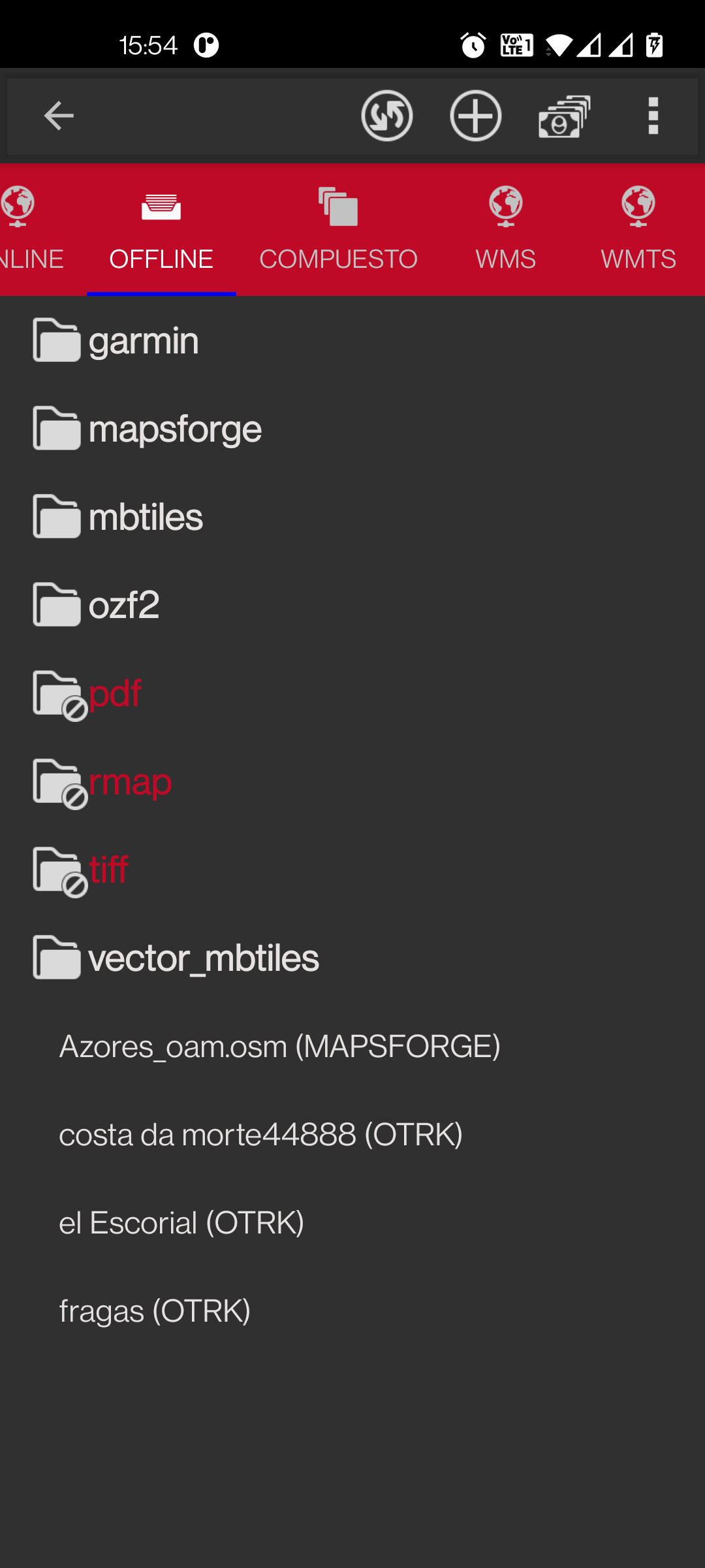
Offline map viewer. Use maps calibrated with OruxMapsDesktop, MOBAC or other PC apps (Manuals and download section)
Support to Mapsforge vectorial maps
Support to GeoPDF (experimental) .pdf maps (USGS store, for example)
Support to Maps offline .rmap
Partial support to Garmin vectorial maps
Support to Maps offline .mbtiles
Support to Maps offline .ozf2
Relief map, using DEM files
3D map viewer, using DEM files
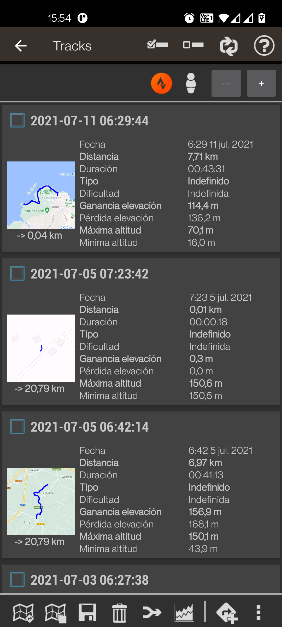
Export your tracks to different format files (gpx, kml and kmz)
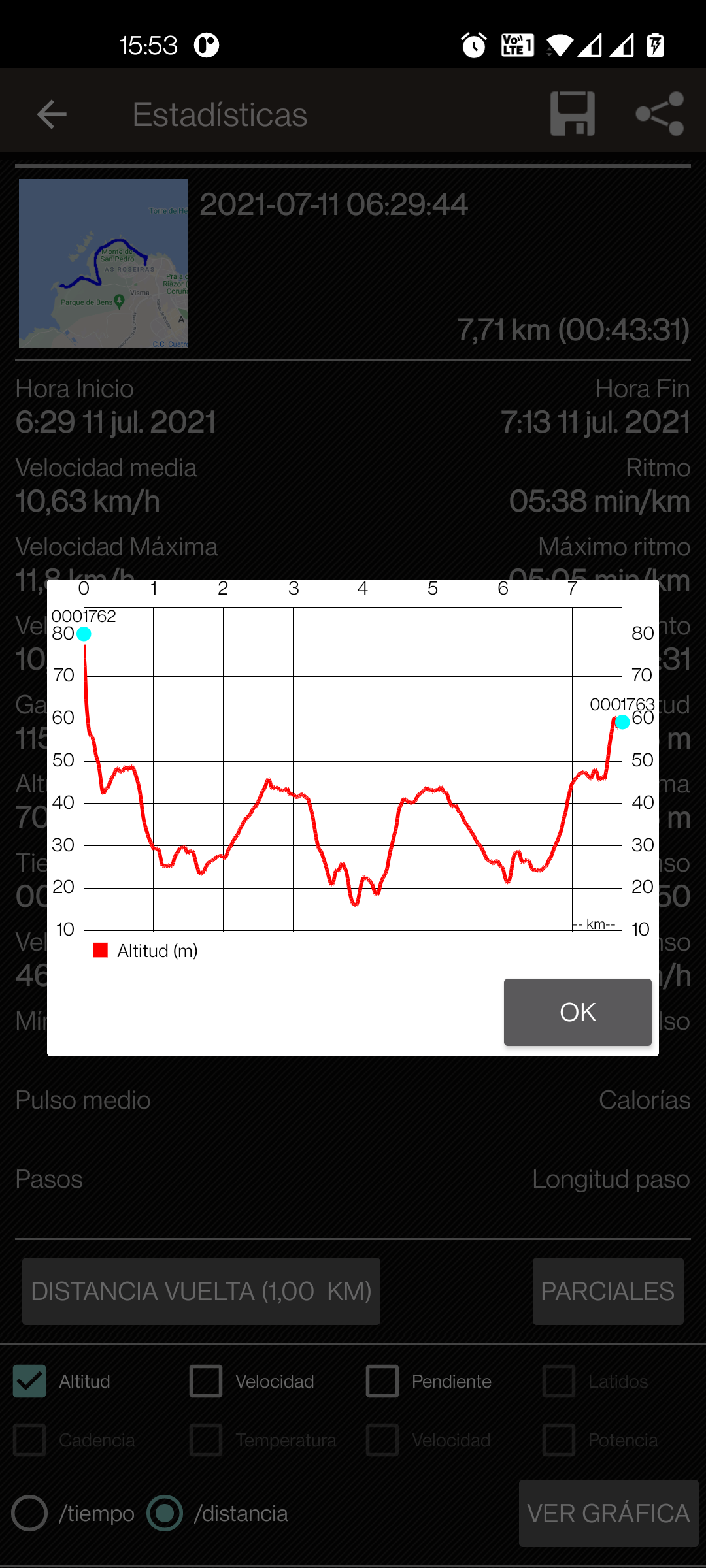
Import/analize your tracks (gpx, kml and kmz)
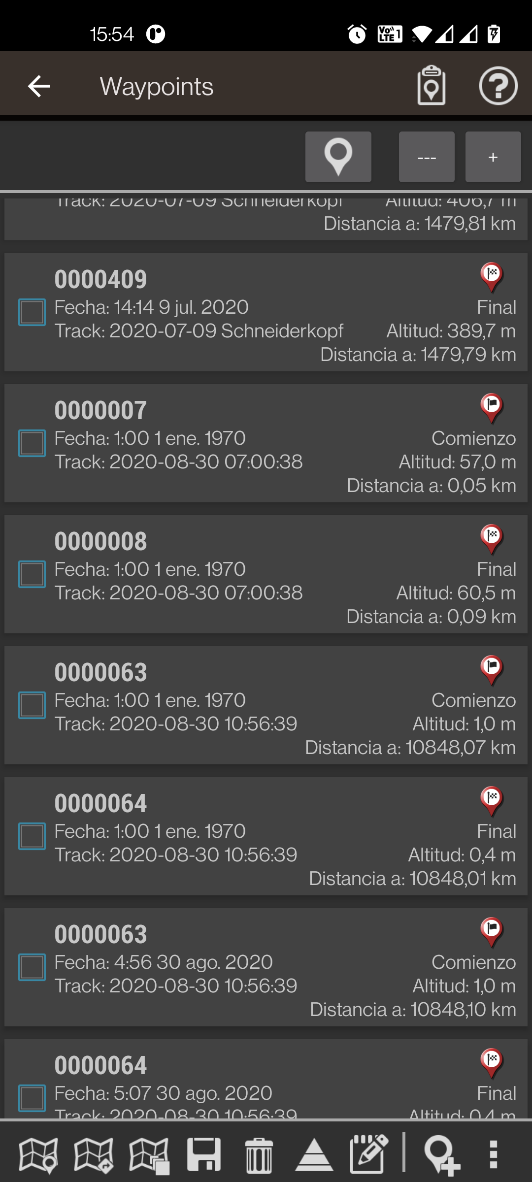
Save your tracks, waypoints and POI,s
Add photos/vodeos/audios to the wpts.
Share your tracks
Share your position with other people
Support to external GPS bluetooth
Support to external heartrate monitors (Bluetooth, BT Smart)
Support to external BT Smart Speed/Cadence Bike sensors
Support to ANT+ (cadence, speed, heart rate, steps, temperature)
Connect with AIS devices (wifi, BT, USB)
Altimeter using device barometer
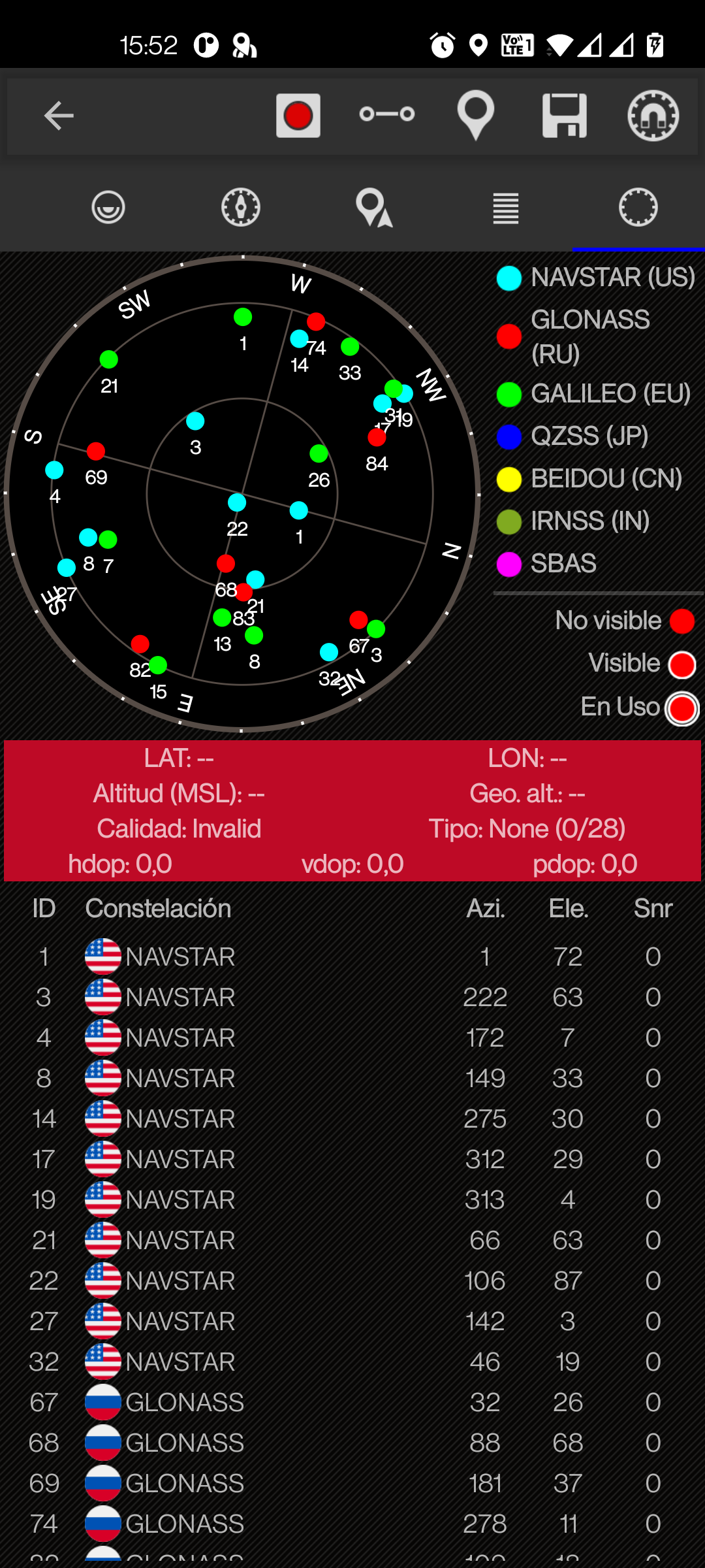
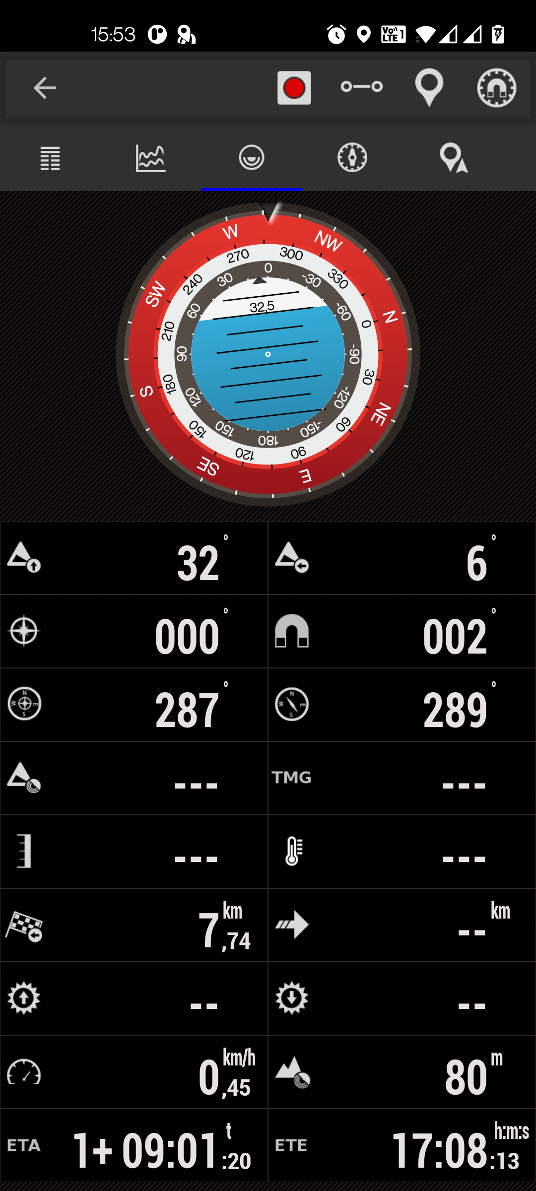
Compass
Upload/download tracks from sicami.com
Live Tracking with mapmytracks.com
Upload tracks to trainingstagebuch.org
Upload/download tracks to/from strava.com
Upload tracks to openstreetmaps.org
Upload tracks to velohero.com
Upload/analize tracks with IBP index

You can buy the app in the Amazon market app.
Planning a route, using the 3D view
Main features
For all your outdoor activities: walking, running, mountain, hiking, trekking, cycling, sailing, skiing,...
Support for multiple map formats. Offline (mapsforge, garmin .img, geopdf, rmap, mbtiles) Online (TMS, WMS, WMTS,...).
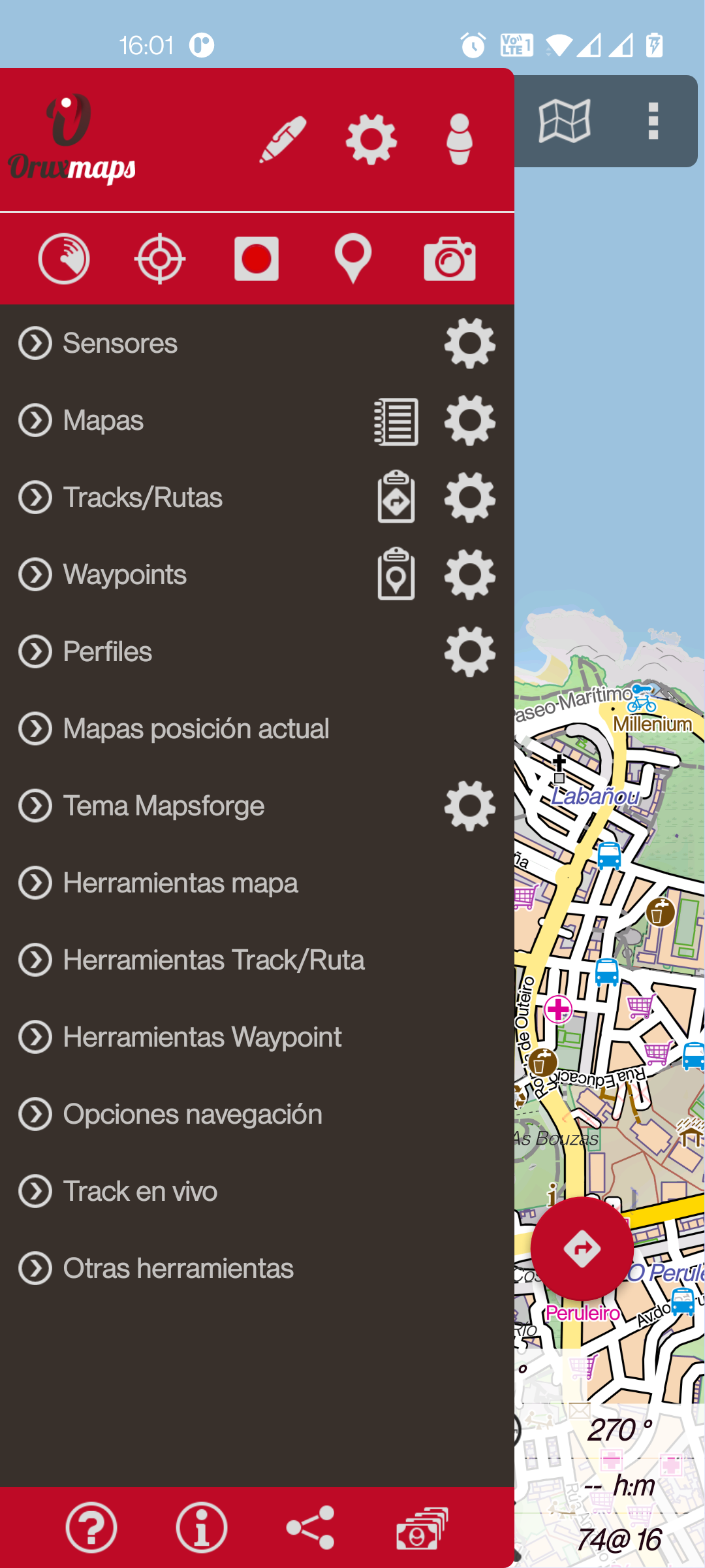
Configure the interface to your liking. Add controls, change colors, buttons,...
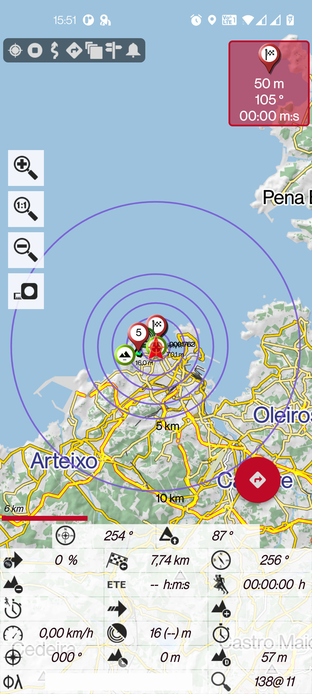
Trip computer view, with multiple views (dashboard, inclinometer, compass, graphs,...).
Plan your tours. Different search engines (online/offline) to obtain the route to follow.
Download online maps for offline use (limited, not possible with all maps).
Calibrate your own maps, starting from an image or a pdf.
Export/import your routes and activities in different formats (GPX, KML, KMZ, TCX, FIT, GeoJSON, CSV,...).
Support for external GPS using Bluetooth devices. Support to NTRIP corrections (device compatible required).
Follow your routes receiving help (alarm when leaving the route, or when approaching waypoints).
Use the app to search for geocaches.
Use polygons (loaded as layers) as exclusion zones or security perimeters.
Record your trips. Add waypoints, with attached photos, videos or audios.
Use different sensors. Heart rate monitors, cadence monitors, bike power sensors. Compatible with ANT+ and Bluetooth LE.
Compatible with pressure sensors, hygrometers, temperature sensors (Internal to the device or Bluetooth LE).
Compatible with AIS systems, connected by IP, BT or USB (requires you to have a server connection).
Compatible with APRS systems (by IP).
3D maps (under subscription). View your routes on 3D maps. You will be able to repeat the route on the map (visualize its route).
Connect the app to OruxSoS, to send alarms by SMS in case of an accident.
Configure the live position service, with sicami.com You can share your position with friends or family.
Use the app as a GIS tool, to draw and paint layers on the maps.
Upload/download your routes and activities to sicami.com and strava.com Upload your activities to mapmytracks.com velohero.com trainingstagebuch.org
Use the app professionally. Generate forms to attach to the points of interest you generate and then export them in CSV format.
Measure distances, calculate seen areas. Also topographic profiles.
Use different profiles, with different settings, for each type of activity you do.
If you are an OpenStreetMaps editor, the app has specific features for you.