
")
Exclusion zones and geofences
You can use polygons loaded from KML, KMZ or SHP files to delimit areas where you don't want to enter, or from where you don't want to leave.
You can also use the drawing tool to delimit those zones of security or exclusion.
How?
1.-Starting from a KMZ or KML file.
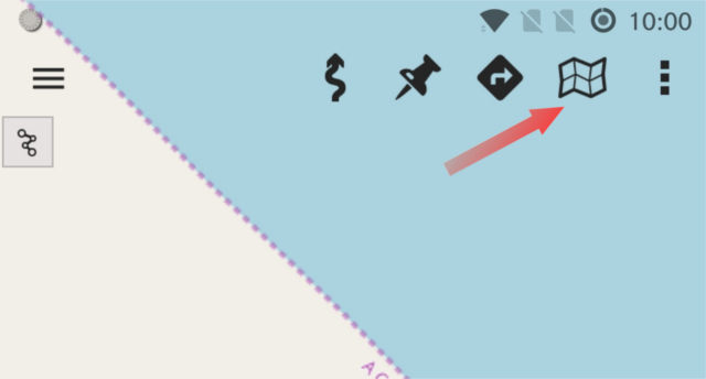
a) From the map viewer, 'maps' button:
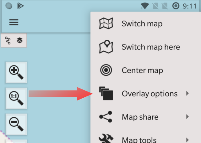
b) Select 'Overlay options' -> 'Load KML/SHP overlay', then browse with the file manager, and load the file containing the polygons.
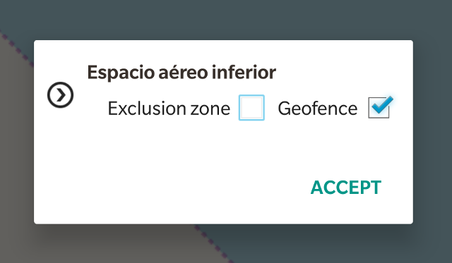
c) Once the polygons are loaded, again button 'maps' -> 'Overlay options' -> 'Tweak layers'. You will get a dialog in which, for each polygon file, or each folder contained in the file, you can select the options 'geofence' and 'exclusion zone'. Once you activate the GPS, if you enter / exit one of these areas, the app will warn you with a beep.
1.-Drawing your own polygons.
a) From the map viewer, 'maps' button.
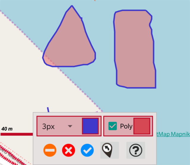
b) Select 'Overlay options' -> 'Draw overlay', then a tool is presented that allows you to draw polygons with your finger on the map (press the 'polygon' option so that the app automatically closes the paths). You can use different line colors and line thickness. Once you finish painting, click on 'OK' and what you have painted is incorporated into the map as a overlay.
c) Once the polygons are loaded, again button 'maps' -> 'Overlay options' -> 'Tweak layers'. You will get a dialog in which, for each polygon file, or each folder contained in the file, you can select the options 'geofence' and 'exclusion zone'. Once you activate the GPS, if you enter / exit one of these areas, the app will warn you with a beep.