
")
GepoPDF maps
OruxMaps supports now GeoPDF format.
It is a standard format that is becoming very common since the data can be vectorial data, which optimizes storage and presentation by layers.
Example of maps of this type is the possibility to download free maps in the USA, directly in the store: https://store.usgs.gov/map-locator
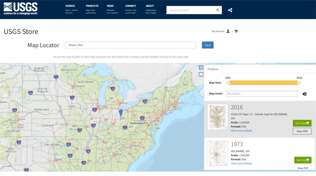
Just by entering a text in the locator, the website provides you with the pdf that you can download.
Once we download the pdf, we copy it in the map list of OruxMaps oruxmaps/mapfiles/ refresh the list of offline maps, and we already have a new map available.